That's kind of off-topic, it doesn't really matter what his political views were, as long as his assessment of the archaeological and ethnolinguistical facts was close to the truth. However, even that is a bit off-topic if being taken too far.
-
Don't want to see ads? Install an adblocker like uBlock Origin or use a Europe-based privacy-friendly browser like Vivaldi or Mullvad.
You are using an out of date browser. It may not display this or other websites correctly.
You should upgrade or use an alternative browser.
You should upgrade or use an alternative browser.
To burn or not to burn: LBA/EIA Balkan case
- Thread starter Southpaw
- Start date
- Status
- Not open for further replies.
TetaEglantina
Regular Member
- Messages
- 822
- Reaction score
- 139
- Points
- 43
- Y-DNA haplogroup
- i2a WHG
Zogu himself ended up being pro-Italian and dependent on Italy. Kruja was ahead of his time. Albania can't stand on its own two legs so it needed to ally with a nearby power that has no genocidal aspirations.
Albania not only stood on its own two legs literally during communism but also tripled it's population. Population now is smaller than late 80s and that's a true failure
PaleoRevenge
Well-known member
- Messages
- 1,529
- Reaction score
- 1,344
- Points
- 113
Albania not only stood on its own two legs literally during communism but also tripled it's population. Population now is smaller than late 80s and that's a true failure
You have no clue what communism is, Tiktok.
blevins13
Regular Member
- Messages
- 1,239
- Reaction score
- 197
- Points
- 63
- Location
- Tirana
- Ethnic group
- Albanian
- Y-DNA haplogroup
- R1b-Z2103>BY611
- mtDNA haplogroup
- H7i1
Zogu himself ended up being pro-Italian and dependent on Italy. Kruja was ahead of his time. Albania can't stand on its own two legs so it needed to ally with a nearby power that has no genocidal aspirations.
blevins13
Regular Member
- Messages
- 1,239
- Reaction score
- 197
- Points
- 63
- Location
- Tirana
- Ethnic group
- Albanian
- Y-DNA haplogroup
- R1b-Z2103>BY611
- mtDNA haplogroup
- H7i1
The following statements is not related to Kruja, we was banned. His conclusion, relate probably more to the country in which he draw them, and I don’t think that was Albania.
“It was a freer world and a freer time. Zog's period is the only time Albanians were truly free, ecomically, culturally and what not.”
As for how free Albanian was at that time, you should read Zogu opposition, including Kruja that should give you an idea.
“It was a freer world and a freer time. Zog's period is the only time Albanians were truly free, ecomically, culturally and what not.”
As for how free Albanian was at that time, you should read Zogu opposition, including Kruja that should give you an idea.
TetaEglantina
Regular Member
- Messages
- 822
- Reaction score
- 139
- Points
- 43
- Y-DNA haplogroup
- i2a WHG
You have no clue what communism is, Tiktok.
I know what communism is but what is Tiktok?
Findings of relevance from the archaeological side of things - I know we discussed this paper before, but the new article made me start a new post with more extensive commenting:
 www.livescience.com
From the paper:
Here we can read anti-migrationist nonsense now factually and completely disproven by ancient DNA, since we have the evidence for the spread of BB like autosomal and R-L2 paternal genetic profiles with the Tumulus culture people, which caused the Koszider horizon:
That's why we can never trust modern post-60's archaeologists when they state that the introduction of new cultural traits and products was the result of "cultural contacts". More often than not, they were wrong.
Notice that they use the term "sharper than would have been viewed..." This might point to some knowledge about genetics (though if they have genetic knowledge, why are they still so reluctant when its about the Tumulus culture expansion?), since the difference between Encrusted pottery (SDZB) and Belegis I/Belegis II-Gáva should indeed be "sharp".
Note that the "modified formats" of SDZB show Channelled Ware/Belegis II dominance rather, like Vartop, so this is a cultural fusion, like we see it in Bulgaria, but most likely based on Channelled Ware (Gáva-related) migrations. Basically we see along the Vardar-Morava (Brnjica) and Danube (Encrusted Pottery) first an influence, later an overtake, of Channelled Ware groups.
LBA megaforts:
Not just burial rite, ceramic production and weapons were similar, but even the architecture and fortifications were similar from Gáva-sphere to Protovillanovans:
This might be an interesting comment concerning the question of continuity from Belegis I to Belegis II-Gáva:
And this is the evidence for the truly massive scale of the South migration from the Tisza zone:

 journals.plos.org
Keeping in mind that a similar pattern could be observed up to the Upper Tisza, in areas like that of Lapus II-Gáva, there can be no doubt that we deal with a truly massive, gigantic folk migration down, towards the South. Clearly affecting other people and causing chain reactions with various people on the move, contributing to the Aegean and Sea Peoples migrations.
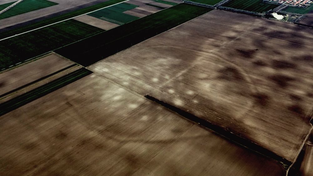
Satellites spy remnants of hidden Bronze Age settlement in Serbia
The more than 3,000-year-old site along a riverbank in Serbia contains the footprints of dozens of Bronze Age structures.
Archaeologists first noticed the remnants of the more than 3,000-year-old enclosures in 2015 while reviewing Google Earth photos of a 93-mile stretch (150 kilometer) of wilderness along Serbia's Tisza River, according to a study published Nov. 10 in the journal PLOS One.
"We could see traces of over 100 Late Bronze Age settlements," study lead author Barry Molloy, an associate professor of archaeology at University College Dublin, told Live Science in an email. "What is fascinating about the [sites] is that we not only identified their presence in these images, but also measured their size and, for many, how people organized the layout inside their settlements."
There are a few clues as to why the settlement would've been so heavily fortified. Based on the discovery of clay chariots and weaponry at cemeteries near some of the enclosures, it's likely that the inhabitants were "familiar with warfare" — not amongst each other, but rather, with the outside world, according to Science.
"[It] would have been occupied from 1600 to 1200 B.C.," Molloy said. "On occasion, we found pieces of burnt daub indicating structures there had been damaged by fire. Daub was soil applied to walls of thin sticks — wattle — to make structures like houses in the past."
However, archaeologists aren't sure what caused the settlement to be abandoned around 1200 B.C.
"This remains a bit of a mystery for now," he said. "It is possible that they simply became more mobile and moved around the landscape in a less constrained manner."
Satellites spy remnants of hidden Bronze Age settlement in Serbia
The more than 3,000-year-old site along a riverbank in Serbia contains the footprints of dozens of Bronze Age structures.
From the paper:
It has been argued the area was marginalised in political and economic networks of Europe and the Mediterranean during the Late Bronze Age (LBA) [12–14]. However, we argue in this paper that a new internally highly-connected and externally well-networked society emerged after 1600 BC, characterised by a dense and hierarchically organised complex of enclosed sites. Located in the south Pannonian Plain area of the Carpathian Basin, these sites were commonly monumental in scale, ranging from small sites of 5–10 hectares, through larger ones of many 10’s of hectares up to the largest site which exceeded 1,750 hectares of space encircled by 33km of ditches and ramparts [15–19]. We aim to explain how this dense and prosperous network came into existence in the 16th century and why it collapsed in the 13th century BC. We contend that, alongside the Aegean and Po Valley, this newly identified lower Pannonian network was one of the major cultural centres of southern Europe, exerting regional scale influences across the continent and into the Mediterranean.
Our fieldwork has identified over 100 new sites in a part of this region. They are located in the hinterlands of the Tisza river and so we term them the Tisza Site Group (TSG). The TSG is a network of highly similar sites set within an area of ca. 8,000 km2, roughly 140km north-south and 80km east-west (S1 File). They are aligned along a broadly north-south axis east of a river corridor formed by the River Tisza and a north-south stretch of the River Danube. The results of our survey provide a basic model for settlement frequency, density, organisation and size. The distribution and locational choices make it clear that TSG sites occupied a strategic location along important arterial river routes that connected them to each other, continental Europe and onwards to the Adriatic, Black and east Mediterranean seas [20]. We present results of remote prospection, pedestrian survey, targeted excavations and new absolute chronological research on this TSG cluster and use this to characterise the lower Pannonian network in its regional and European context.
Here we can read anti-migrationist nonsense now factually and completely disproven by ancient DNA, since we have the evidence for the spread of BB like autosomal and R-L2 paternal genetic profiles with the Tumulus culture people, which caused the Koszider horizon:
The long-standing Tumulus Culture invasion model was introduced to explain the adoption of new material culture styles from the 16th century BC, prompting arguments for a causal relationship between inward migration and the fall of the tells, an idea now out of vogue [5, 41–46]. This model was based in part on the development of distinctive metalwork of the so-called “Koszider horizon” (ca. 1600–1450 BC) along with the “Tumulus culture” or HGK (Hügelgräber-Kultur) pottery style of the same general date range [44, 47]. Recent work demonstrates that the introduction of these was asynchronous, gradual and embedded within local craft and societal dynamics [48].
In general, the southward spread of the consumption of tumulus culture and encrusted ware styles signal mobility. While we may only speculate on whether this was people, things or ideas on the move, it correlates with a disruptive phase at the end of the MBA. Their introduction alongside other ceramic styles is relevant for understanding the late 17th to 16th centuries BC as a pivotal time of reorganisation across the southern plain [54].
That's why we can never trust modern post-60's archaeologists when they state that the introduction of new cultural traits and products was the result of "cultural contacts". More often than not, they were wrong.
Notably, the co-occurrence of Belegiš I and SDŽB at TSG settlements, and the common use of incised and / or encrusted decoration, suggests our division between the two, based primarily on cemetery assemblages, is perhaps sharper than would have been viewed in prehistory. When the Belegiš II pottery style emerged, many features such as hanging garland decoration, cylindrical necks with everted rims and four equispaced protomes derived from the Belegiš I style. These features were shared also in a modified format on later SDŽB pottery, demonstrating entanglement of concepts even when broader decorative techniques were adhered to.
Notice that they use the term "sharper than would have been viewed..." This might point to some knowledge about genetics (though if they have genetic knowledge, why are they still so reluctant when its about the Tumulus culture expansion?), since the difference between Encrusted pottery (SDZB) and Belegis I/Belegis II-Gáva should indeed be "sharp".
Note that the "modified formats" of SDZB show Channelled Ware/Belegis II dominance rather, like Vartop, so this is a cultural fusion, like we see it in Bulgaria, but most likely based on Channelled Ware (Gáva-related) migrations. Basically we see along the Vardar-Morava (Brnjica) and Danube (Encrusted Pottery) first an influence, later an overtake, of Channelled Ware groups.
LBA megaforts:
Surviving upstanding ramparts are rare and are associated with the larger and most monumental sites, the extreme case being Corneşti Iarcuri at ca. 1765 ha [107]. This was the largest construction built in any part of Europe up to that time, dwarfing the citadels of the Aegean world and their surrounding towns. Other impressive sites, while smaller, were nonetheless massive relative to earlier and contemporary sites in Europe, with sites such as Sântana Cetatea Veche, Gradište-Iđoš, Sakule, Crepaja, Bašaid, Csanádpalota, Orosháza Nagytatársánc and Újkígyós all warranting the term megasite or megafort, ranging from 75 to 460 Ha of enclosed space (Fig 1)
Not just burial rite, ceramic production and weapons were similar, but even the architecture and fortifications were similar from Gáva-sphere to Protovillanovans:
At the 130ha site of Sântana, located north of the Mureș, exceptionally wide ramparts were constructed that are unique in the area and the excavators point to similarities with Terramare ramparts in northern Italy [19].
This might be an interesting comment concerning the question of continuity from Belegis I to Belegis II-Gáva:
Considering our survey finds, there is a greater frequency of sites that have only Belegiš I / SDŽB pottery along with relatively fewer or no sherds of Belegiš II in the southern site cluster (Table 2). It is emphasised that this can be a bias of the recovery of diagnostic sherds, as only a handful of diagnostics were recovered from sites that only had Belegiš I pottery. Nonetheless, the difference in assemblages between sites north and south of the Bega appears to be a real phenomenon. This can be explained in two ways. The first is that the making of Belegiš II pottery and displacement of Belegiš I occurred gradually during the 14th century BC, with the stylistic trend spreading from the north while SDŽB was still being made in the southern cluster, thereby blurring or offsetting the LBA 1–2 ceramic transition more there than it does in the northern cluster. The other possibility is that a higher proportion of sites in the south were abandoned before LBA 2.
And this is the evidence for the truly massive scale of the South migration from the Tisza zone:
Based on both relative and absolute chronologies, all TSG sites appear to have been abandoned in the decades around 1200 BC. Of these, only the largest sites at Gradište Iđoš, Sakule and possibly Bašaid have indicators of reoccupation in small areas during the 11th to 10th centuries BC. The site of Jaša Tomić is an exception as this exhibits TSG features but was (probably) a new foundation of 12th to 10th centuries BC based on pottery recovered.
Absolute and relative dates suggest that TSG sites and cemeteries–and indeed most of the lower Pannonian network–were abandoned en masse around 1200 BC. It is noteworthy that this was precisely the time of the contraction of settlement on the Titel plateau and reoccupation of the tell at Mošorin-Feudvar. A similar pattern, based on surviving strata, is probably detected at Židovar, which was resettled. No re-occupation horizon is observed at tells in the area of the Maros group in the 12th century BC. These changes indicate that knowledge of tell sites was sustained in societies during LBA 1–2 but they were marginalised as loci for settlement until another major societal shift took place after 1200 BC through which loci for LBA settlements were rejected.
Resilience, innovation and collapse of settlement networks in later Bronze Age Europe: New survey data from the southern Carpathian Basin
Societies of the later Early to Middle Bronze Age (ca. 2200–1600 BC) in the Carpathian Basin exhibited complex, hierarchical and regionally influential socio-political organisation that came to an abrupt end in the 16th century BC. Considered a collapse by some, this change was characterised by...
journals.plos.org
Keeping in mind that a similar pattern could be observed up to the Upper Tisza, in areas like that of Lapus II-Gáva, there can be no doubt that we deal with a truly massive, gigantic folk migration down, towards the South. Clearly affecting other people and causing chain reactions with various people on the move, contributing to the Aegean and Sea Peoples migrations.
TetaEglantina
Regular Member
- Messages
- 822
- Reaction score
- 139
- Points
- 43
- Y-DNA haplogroup
- i2a WHG
So another example suggesting that Urnfield expansion wasn't peaceful
Last edited:
So another example suggesting that Urnfield expansion wasn't peaceful
What's most important is the sheer size. We deal with some of the biggest settlements, some of the most advanced warriors and metallurgists of that era, they lived in dense settlements along the Tisza and its tributaries, and then, suddenly, at the end of the LBA, from Ukraine to Serbia they are on the move. It can't be stressed enough how big this movement must have been for that time, when one of the biggest ethnocultural formations of Europe in that era, nearly the whole Carpatho-Balkan cremation block, began to move.
Whether they were under pressure themselves from the North East, because of steppe incursions, whether it was the climate or ending ressources, or simply the riches of the South they knew from their Mycenaean contacts, we don't know for sure, but if looking at the magnitude, this movement should dwarf many of the later historically attested tribal migrations. Even by total numbers, let along in relative terms for the context of that time.
TetaEglantina
Regular Member
- Messages
- 822
- Reaction score
- 139
- Points
- 43
- Y-DNA haplogroup
- i2a WHG
They always say this "remains a bit of a mystery" when they don't want to accept the truth. The truth is Mycenaean cities were burned and destroyed, Tollense war was massive and now this in LBA Serbia cannot just be mysteries - they all happened in the period of 1250BC-1150BC. There was a major force emerging in Europe, this to me looks like a religious/cultural conquest across Europe from Baltic sea to Greece and possibly beyond
Last edited:
TetaEglantina
Regular Member
- Messages
- 822
- Reaction score
- 139
- Points
- 43
- Y-DNA haplogroup
- i2a WHG
Cremation emerging in Nordic bronze age along with non locals -

 www.ncbi.nlm.nih.gov
Into the fire: Investigating the introduction of cremation to Nordic Bronze Age Denmark: A comparative study between different regions applying strontium isotope analyses and archaeological methods
Changes in funerary practices are key to the understanding of social transformations of past societies. Over the course of the Nordic Bronze Age, funerary practices changed from inhumation to cremation. The aim of this study is to shed light on this fundamental ...
www.ncbi.nlm.nih.gov
Archetype0ne
Regular Member
- Messages
- 1,777
- Reaction score
- 693
- Points
- 113
- Ethnic group
- Albanian
- Y-DNA haplogroup
- L283>Y21878>Y197198
Amazing how he misses the Northern regions and the Urnfield phenomenon so completely from his calculation. His view is rather limited on the historically attested, writing civilisations, but those were interconnected with the Urnfield people, especially those of the Carpathian basin and Northern Italy as their periphery. And those made a huge leap forward, technologically and militarily, exactly in that time frame (Naue II/Reutlingen slashing swords, casted spearheads, new tactics with larger shields - kind of pre-hoplite style). The chain reaction caused by their expansion, even in areas they didn't conquer directly, is definitely the main factor for the collapse.
Once the events were started, the systemic approach he suggested is working, since the whole network went down at once due to the first invasions already.
He clearly states those people which survived did recover in a couple of decades, its those which didn't survive as a settled, composed ethnic group, in their old tradition, which really went down culturally. That's because they were conquered, while the others (Egyptians, Assyrians, Babylonians) were just damaged and there was no such fundamental break by comparison (with the Mycenaeans, Hittites etc.).
Last edited:
TetaEglantina
Regular Member
- Messages
- 822
- Reaction score
- 139
- Points
- 43
- Y-DNA haplogroup
- i2a WHG
"Early Bronze Age geometric and linear motifs, in particular the use of double-axe and spirals motifs, looked to be the result of Mycenaean influences. The art of the Urnfield Culture was thought to be the result of an invasion of people from the east, bringing cremation and a new art style into Europe. La Tène art was associated with the Celtic people, and their spread throughout large parts of Europe was assumed to have brought this art to different areas."
"The first is the development of the sun-bird-ship motif of the Urnfield Culture. The origin of this motif, which featured bird-headed ships embellished with solar disks, is not known, but over a short period about 1400 BCE it became common both as incised decoration and as plastic art throughout a vast area of eastern and central Europe. The similarity in execution and composition is remarkable and suggests a shared understanding of its meaning and the intensity of contact between distant areas."
Sea People's description - https://www.usni.org/magazines/naval-history-magazine/2021/april/last-great-pharaoh-vs-sea-peoples
Last edited:
I find it interesting that the vast majority of the Sea Peoples seem to have had no Naue II swords or gained it just later. This might point to the fact that they were, in their majority, the tribes being pushed by the Urnfielders, rather than Urnfielders themselves. Because right in that time frame, both in Italy and the Carpathian Basin, down into the Central Balkans, the Urnfielders had a huge production of Naue II/Reutlingen swords. And they used long spears/lances, sometimes with flame shaped, casted spearheads. Again, I'm not aware of those appearing with the Sea Peoples. However, they appear in Italy and Greece.
This suggests to me that especially Gáva-related people, while possibly involved, where a small minority only, but the majority of the Sea Peoples were rather those which fled from Protovillanovans and Gáva-related Channelled Ware people.
This can also be noticed in areas like Troy, where there seems to have been not just one, but multiple waves of invaders, with the most clearly Thracian groups being last.
Southpaw
Regular Member
- Messages
- 2,618
- Reaction score
- 1,424
- Points
- 113
- Ethnic group
- Albanian
- Y-DNA haplogroup
- E-V13
One new sample under E-V13 FGC33621 (Berisha-Sopi cluster): https://www.yfull.com/tree/E-FGC33614/
from Trieste/Venice area, would be cool if there is a continuity from Veneti/Histri or he is a recent immigrant. Further up there is again 1 Italian (unknown which region) and 1 German but still not yet listed in yfull.
from Trieste/Venice area, would be cool if there is a continuity from Veneti/Histri or he is a recent immigrant. Further up there is again 1 Italian (unknown which region) and 1 German but still not yet listed in yfull.
TetaEglantina
Regular Member
- Messages
- 822
- Reaction score
- 139
- Points
- 43
- Y-DNA haplogroup
- i2a WHG
I find it interesting that the vast majority of the Sea Peoples seem to have had no Naue II swords or gained it just later. This might point to the fact that they were, in their majority, the tribes being pushed by the Urnfielders, rather than Urnfielders themselves. Because right in that time frame, both in Italy and the Carpathian Basin, down into the Central Balkans, the Urnfielders had a huge production of Naue II/Reutlingen swords. And they used long spears/lances, sometimes with flame shaped, casted spearheads. Again, I'm not aware of those appearing with the Sea Peoples. However, they appear in Italy and Greece.
This suggests to me that especially Gáva-related people, while possibly involved, where a small minority only, but the majority of the Sea Peoples were rather those which fled from Protovillanovans and Gáva-related Channelled Ware people.
This can also be noticed in areas like Troy, where there seems to have been not just one, but multiple waves of invaders, with the most clearly Thracian groups being last.
They may have been recruited by Urnfield elites and not given the advanced swords or the swords were not mass produced by this point. The ships themselves that Sea People's used seem to be related to Urnfield
Last edited:
Archetype0ne
Regular Member
- Messages
- 1,777
- Reaction score
- 693
- Points
- 113
- Ethnic group
- Albanian
- Y-DNA haplogroup
- L283>Y21878>Y197198
I have not watched that professor in a couple of years so not sure. Point is civilization collapsed at such a large geographical scale that it could not have been something mundane, but systemic. My bet is either climate change ecosystems failures or something equally as catastrophic.
TetaEglantina
Regular Member
- Messages
- 822
- Reaction score
- 139
- Points
- 43
- Y-DNA haplogroup
- i2a WHG
I have not watched that professor in a couple of years so not sure. Point is civilization collapsed at such a large geographical scale that it could not have been something mundane, but systemic. My bet is either climate change ecosystems failures or something equally as catastrophic.
Absolutely no chance. Wars and destruction of cities are recorded from Germany down to Anatolia between the period 1250BC - 1150BC, even Ancient Egypt
This was like a Bronze Age World War except mostly confined to Europe. Following these wars cremating with urns immediately became the new norm for a lot of regions - why would climate change make people burn the dead?
I have not watched that professor in a couple of years so not sure. Point is civilization collapsed at such a large geographical scale that it could not have been something mundane, but systemic. My bet is either climate change ecosystems failures or something equally as catastrophic.
Rather not, because these civilisations did survive such incidents earlier and there is absolutely no reason for such a steep decline in any of this. The main cause was definitely and without a doubt the invasion of foreign tribes. This is also the reason why Egypt was doing best (could defend itself), Babylonians and Assyrians second best (were affected, but not completely overrolled), but the Mycenaeans, Trojans, Hittites etc. were just gone or just a shadow of their former self.
These were hit the hardest by the invading forces.
And its completely wrong to view things isolated, because the Urnfield migrations didn't just affect the Eastern Mediterranean, they reached as far as Britain and Spain, the Baltic Sea and the Western steppe.
- Status
- Not open for further replies.